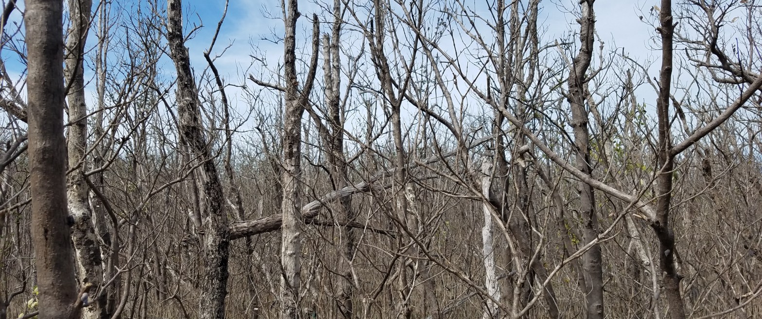
Hurricanes can drastically change the structure and composition of coastal ecosystems. Hurricane Irma, one of the strongest hurricanes ever recorded in the Atlantic, first made landfall in the Florida Keys archipelago before coming ashore in southwestern Florida near Everglades National Park (ENP) on September 9th and 10th of this year. Strong winds in excess ofContinue reading “Resilience & Vulnerability to Disturbances”
Author Archives: dlagomas
Workshop: Remote Sensing Applications for Wetland Inventories
Coastal wetlands hold tremendous economic, recreational, and commercial value. These system are highly sensitive to changes in salinity and hydrology that are brought upon by sea level rise, saltwater intrusion, and human manipulation. Remote sensing is an effective tool to monitor changes to wetland ecosystems, and model ecosystem structural and functional parameters. In June ofContinue reading “Workshop: Remote Sensing Applications for Wetland Inventories”
Welcome to Mangrove Science
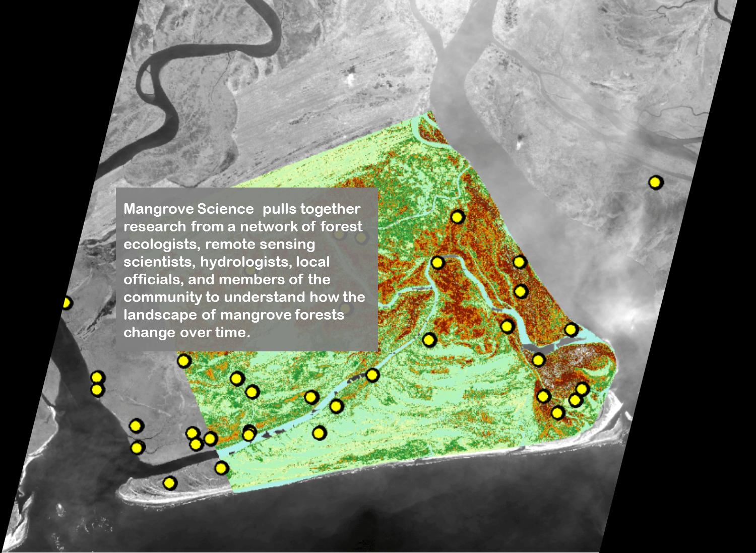
This is Mangrove Science Mangrove Science pulls together research from a network of forest ecologists, remote sensing scientists, hydrologists, local officials, and members of the community to understand how the landscape of mangrove forests change over time. Browse the website to find out more about our past, current and pending projects. Mangrove data products includingContinue reading “Welcome to Mangrove Science”
Data User Survey
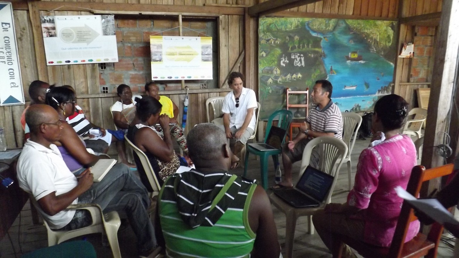
African Blue Carbon

Mangroves and tidal wetlands have the highest carbon density among terrestrial ecosystems. Although they only represent 3 % of the total forest area (or 0.01 % of land area), C emissions from mangrove destruction alone at current rates could be equivalent to 10 % of carbon emissions from deforestation. Due to their location along highlyContinue reading “African Blue Carbon”
SilvaCarbon – Bangladesh

Mangrove ecosystems can store large quantities of carbon that are used to determine their global value for programs such as REDD and REDD+. Bangladesh has 710 kilometers of coasts. The coastal zone covers 19 coastal districts in the Bay of Bengal. This includes Bangladesh’s Sundarbans, which is the world’s largest contiguous mangrove forest. Coastal mangroveContinue reading “SilvaCarbon – Bangladesh”
South Florida Coastal Ecosystem Vulnerability
Mangroves represent only 3% of the global forest cover, but the current degradation of pantropical mangrove forests is responsible for approximately 10% of the total carbon emissions from deforestation worldwide (Donato et al, 2011). Beyond being one of the most carbon dense ecosystems due to their high carbon sequestration rates (Donato et al, 2011; PendletonContinue reading “South Florida Coastal Ecosystem Vulnerability”
Become a Subscriber
Are you interested in receiving more information about Mangrove Science and our current research projects? Fill out the form below and tell us why you are are interested in mangroves.
