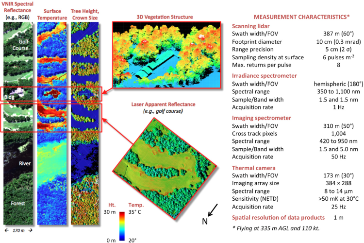
G-LiHT is a portable, airborne imaging system that is able to map the composition, sturcture, and function of terrestrial ecosystems by means of three unique capabilities; LiDAR, imaging spectroscopy, and thermal measurements at a fine-scale resolution of < 1 meter for a wide range of platforms. It is important to note that when imaging different areas it is often difficult to study land area with varied structural and spectral composition. Take for example a forest landscape that has been fragmented by urban sprawl, the thermal reluctance and ability to differentiate canopy heights from other features is augmented by this multi-faceted instrument approach.
Objectives
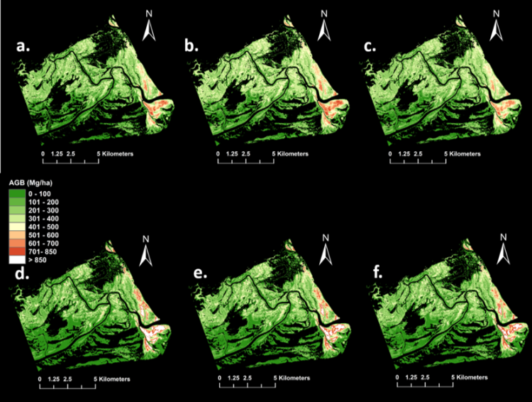
The synthesis of sensors and data will help to analyze ecosystem form and function with a certain focus on the data products needed to create finer-scale models of structure, spectral, temperature characteristics of vegetation (Cook, et al., 2013). This instrument is readily applicable to the dynamic landscape of mangrove forests. Let’s take a look at one of our more recent publications by Dr. Fatoyinbo using LiDAR data to estimate Zambezi mangrove biomass.