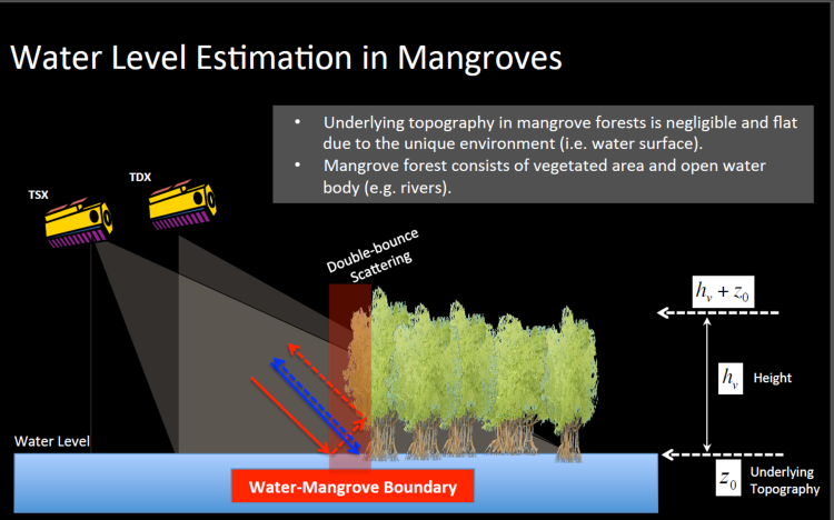
TanDEM-X is the first single-‐pass interferometric SAR satellite system. By emitting and receiving synthetic radar waves from two separate satellites flying in formation, we can analyze height information without complications from images collected at different times. The main objective of the TanDEM-X mission is to globally map the Earth’s elevation at a resolution of 12 x 12 meters. This information collected by the German Space Agency (DLR) is not the first globally available digital elevation data, but it does provide more detailed measurements than earlier techniques like the Shuttle Radar Topography Mission in 2000 and the Geoscience Laser Altimeter System that was aboard Ice, Cloud, and Elevation Satellite (ICESat) from 2004-2010
We have developed the methodology to estimate mangrove canopy heights using TDX with low errors of 1 to 2 meters when compared to lidar data and field surveys. We recently developed canopy height maps for Pongara National Park in Gabon (Africa). Some of the tallest trees in the park reach nearly 60 meters (~197 ft),
We currently have canopy height data available for mangroves forests in Mozambique, Tanzania, Gabon, Bangladesh, United States, Mexico, and more. Check the data portal for access to land cover and canopy height maps.
