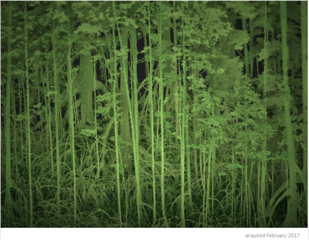
A 3D model of the park’s taller mangroves derived from the Terestrial Laser Scanner (TLS). The TLS shoots laser pulses that can measure distance to an object allowing for three dimensional reconstruction of forests.
Monitoring & Modeling with Remote Sensing
A 3D model of the park’s taller mangroves derived from the Terestrial Laser Scanner (TLS). The TLS shoots laser pulses that can measure distance to an object allowing for three dimensional reconstruction of forests.
